


LEP Zoning Maps
Click on the different panels on the map below to display detailed Zoning Maps of the individual areas. Click on the small blue rectangles to display detailed Zoning Maps of the individual towns and villages.
These maps are those that are provided with the (November 2012) draft that is on public exhibition until 8 March 2013..
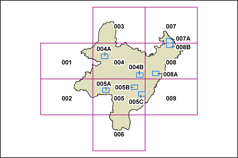
A more detailed locality map covering the Palerang LGA is available under the Wamboin Maps section accessible through the left side menu.